
Day 4: Patterdale to Shap
Having had an early bed the night before, and as we needed to have my rucksack packed for the sherpa van by 9am, we were up quite promptly. To Dave's absolute disgust, I finished off the Haribo for breakfast. Dave then cooked our proper breakfast, and by proper I mean bacon and egg fried rice - we'd got in too late yesterday to buy any bread. I raided our first aid kit for something that wouldn't cause my feet even more harm, and managed to find an "unmedicated dressing" which I used on my right heel, whereas I went back to normal plasters and tape on my left heel. I also changed the kind of inner socks (I wear two pairs for walking) I was using for the special "walking" socks I'd bought for the trip, to my usual cotton ones from Next. My theory was that the smoother, thinner cotton socks would move around less inside the big walking socks I was wearing, compared to the thick, furry special "walking" socks, and therefore wouldn't:
a) peel off any plasters I'd put on while I walked
b) not rip my feet to shreds in the first place
There you go: a paragraph on socks. I bet you didn't think this diary could get much more interesting, did you?
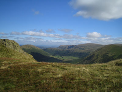
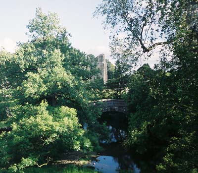
We left the rucksack at the farm for the sherpa van, and then set off. I ended up running back again about 5 minutes later when we realised I'd forgotten to leave the transport charge in it. We stopped at the local post office to buy some food, and Dave nearly bought some of those fancy metal walking sticks. To start off the day we had a 200m quick climb, followed by a gradual 400m climb to the highest point of the Coast to Coast. The initial hill wasn't too bad, although my feet were sore so I wasn't in the best of moods. By the top of the first climb though, I'd managed to 'walk them in' for the day, and so they started to feel much better. Well, as better as two gaping holes in your feet can feel. We had a quick stop to admire the view of Patterdale:

I was in a pretty good mood though at this point, and while chatting about the days behind us, I decided to write this diary. Bad luck, readers.
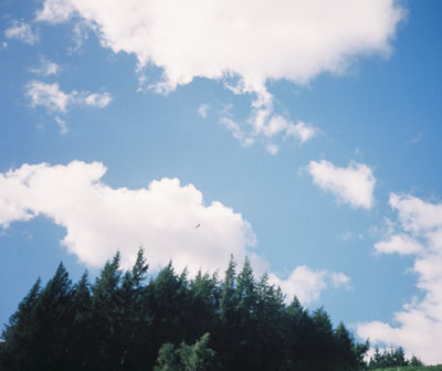
We also decided to take more photos:

At the top of "The Knott", we decided to take a compass bearing to check we were where we thought we were. Remember yesterday, when my compass bearing didn't fit in with the map? Well, here the exact same thing happened. After a bit of confusion and waving about of the compass, we came to the conclusion that it was broken, in that North wasn't generally in the same direction twice. We pulled out the other compass, took a proper bearing, confirmed it with my belt compass (thanks, Mum), and went on our way.

We soon came across a friendly man who was walking the same way as us, so we had a bit of a chat with him as we went. He must have been in his mid 70's and he was just doing a few of the mountains before lunch. Impressive. When he found out we were doing the Coast to Coast, he innocently said, "Oh, that's great fun. I did that in my 60's. I couldn't do it now though." Even more impressive.
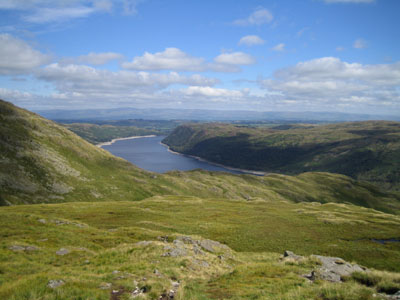
We reached Kidsty Pike, which at 770m is the highest point of the Coast to Coast. The view was pretty amazing, so we took a few minutes to take a proper panoramic photo:

We started our descent down to Hayeswater Reservoir. Apparently, there used to be a town at the southern end of it (Wood Howe) but it got flooded when they built the dam. A bit harsh on the people who were forced to move, but it did make for some very nice photos:

Dave was very slow again on the way down because of his knee, so I took advantage of our altitude, and hence the luxury of actually having some phone reception, and read the texts I'd been unable to check the last couple of evenings. The sun was pretty strong and I could feel myself burning, so I dug my sunglasses and sun cream out of my bag. I tucked the sunglasses into my rucksack's hip strap so I could sun cream my face, but somehow they came out and I lost them. It was annoying as I'd had these glasses for about 10 years. My friends used to say they looked like they were out of a McDonald's happy meal (they weren't). I didn't let it ruin my day though.

We ran into a couple from Germany who were walking the other way. They saw Dave and just said, "So you're the guy with the injured knee then". Apparently the news was spreading. The man recommended he bought a couple of sticks and Dave said he regretted not buying them that morning. As if to prove this, at one point Dave sat on his arse and slid down a bit of hill because he said it was easier than walking it.
We had lunch at the bottom, then walked alongside Hayeswater Reservoir. It was very hot now. A plane that was flying around obviously saw how hot we were and tried to shade us from the sun. It failed.
We caught up with the Australians when we still had about 4.5 miles to go and so ended up walking the remainder of the day with them.
It was their last day of walking, so when we got into Shap we took some photos together and arranged to meet them for dinner at The Bull's Head Inn, where we were staying for the night.

When we got to the pub, our bag was waiting there thanks to the sherpa van. The campsite was just the pub's beer garden, like the first campsite we'd stayed in but this time with an outside tap. Unlike the first campsite though, this one was costing us £5 each and was covered in poo, courtesy of the owners' dogs. The smaller dog kept stealing my socks when I was taking my boots off which was funny at first but just got annoying after a while. All in all, it was a pretty rubbish campsite.
We met up with Dave and Rebecca for dinner which was very nice, and Dave and I got 25% off as we were camping there. Personally, I would have paid that 25% to have had a campsite that wasn't crap, but there you go. We wished them both a fun rest of their holiday and went off to bed. After a quick discussion, Dave and I agreed that we should sherpa the big rucksack every day from now on, so we rang to arrange it. As I fell asleep I heard some other lads drunkenly trying to put up their tents.
Day 4 Stats:
Distance: 16.5 miles
Total Ascent: 1117m
Total Descent: 1015m
Time taken: 8.5 hours
SMR (Stile-to-Mile Ratio): 1.21


0 Comments:
Post a Comment